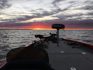
TPWD and partners maintain a series of brush piles on Canyon Lake, Texas.
 |
The brush piles are updated annually (for the most part),
especially on the lower half of the lake (nearer the dam).
|
Here are the GPS coordinates.
| Canyon Reservoir Fish Attractor Project |
| Updated April 26, 2016 |
|
|
|
|
|
|
|
|
|
| Site # | Lat/Long | Attractor Description | Installed | Last Supplemented |
| 1 | N 29o51.697' | Mouth of Turkey Cove on east main lake point along river channel drop. |
|
|
| W -98o13.027' |
|
|
|
|
| 2005 | 2014 |
| 2 | N 29o51.597' | In Turkey Cove on rocky bald Y-point splitting cove. |
|
|
|
| W -98o13.190' |
|
|
|
|
| 2005 | 2014 |
| 3 | N 29o53.707' | Along Jacobs Creek channel drop off. |
|
|
|
|
| W -98o12.911' |
|
|
|
|
| 2005 | 2016 |
| 4 | N 29o51.096' | Along creek channel drop in small cove uplake from dam. |
|
|
|
| W -98o12.693' |
|
|
|
|
| 2005 | 2014 |
| 5 | N 29o51.676' | Bald secondary point on North side of Turkey Cove east of ramp. |
|
|
| W -98o13.394' |
|
|
|
|
| 2005 | 2013 |
| 6 | N 29o53.918' | West side of long rocky point between Cranes Mill and Potters Creek along river channel drop. |
|
|
| W -98o16.949' |
|
|
|
|
| 2005 | 2015 |
| 7 | N 29o53.979' | West side of long rocky point between Cranes Mill and Potters Creek along river channel drop. |
|
|
| W -98o16.994' |
|
|
|
|
| 2005 | 2016 |
| 8 | N 29o54.554' | On main point splitting north side cove along deep ledge. |
|
|
|
| W -98o17.814' |
|
|
|
|
| 2005 | 2013 |
| 9 | N 29o54.467' | Main lake point up-river from water pipeline along deep river channel drop. |
|
|
| W -98o17.361' |
|
|
|
|
| 2005 | 2013 |
| 10 | N 29o54.118' | End of bald clay point at Potter's Creek Park near river channel drop. |
|
|
| W -98o16.157' |
|
|
|
|
| 2005 | 2015 |
| 11 | N 29o53.492' | Cranes Mill fishing pier. Along North edge of pier and in middle pier hole. |
|
|
| W -98o17.690' |
|
|
|
|
| 2005 | 2013 |
| 12 | N 29o53.343' | Ledge along steep bank near point. |
|
|
|
|
| W -98o15.866' |
|
|
|
|
| 2005 | 2015 |
| 13 | N 29o53.698' | Ledge on rocky bank along east side of Canyon Park in ramp cove. |
|
|
| W -98o13.840' |
|
|
|
|
| 2005 | 2014 |
| 14 | N 29o53.756' | Ledge on rocky bank along east side of Canyon Park in ramp cove. |
|
|
| W -98o13.839' |
|
|
|
|
| 2005 | 2014 |
| 15 | N 29o54.539' | End of extended point west of Canyon Park area near drop off. |
|
|
| W -98o14.247' |
|
|
|
|
| 2005 | 2015 |
| 16 | N 29o51.530' | On southeast side of Comal Park cove along creek channel drop. |
|
|
| W -98o14.722' |
|
|
|
|
| 2005 | 2014 |
| 17 | N 29o52.762' | End of west Jacobs Creek main lake point. |
|
|
|
|
| W -98o13.514' |
|
|
|
|
| 2005 | 2015 |
| 18 | N 29o52.669' | End of east Jacobs Creek main lake point. |
|
|
|
|
| W -98o13.467' |
|
|
|
|
| 2005 | 2015 |
| 19 | N 29o52.181' | East side of North Park main lake point. |
|
|
|
|
| W -98o12.362' |
|
|
|
|
| 2007 | 2015 |
| 20 | N 29o51.913' | Along drop off on North Park extended main lake point. |
|
|
|
| W -98o12.422' |
|
|
|
|
| 2007 | 2013 |
| 21 | N 29o51.835' | Southeast corner of dam. |
|
|
|
|
|
| W -98o11.844' |
|
|
|
|
| 2007 | 2015 |
| 22 | N 29o52.419' | Northeast corner of dam. |
|
|
|
|
|
| W -98o11.994' |
|
|
|
|
| 2007 | 2015 |
| 23 | N 29o52.301' | On the end of island/hump marked with buoy. |
|
|
|
|
| W -98o13.973' |
|
|
|
|
| 2007 | 2014 |
| 24 | N 29o51.642' | Along creek channel near Comal Park. |
|
|
|
|
| W -98o14.892' |
|
|
|
|
| 2007 | 2015 |
| 25 | N 29o52.608' | East side of Jacobs Creek main lake point. |
|
|
|
|
| W -98o13.269' |
|
|
|
|
| 2007 | 2013 |
| 26 | N 29o52.538' | On the end of point northeast of Tom Creek boat ramp. |
|
|
|
| W -98o15.475' |
|
|
|
|
| 2007 | 2016 |
| 27 | N 29o54.033' | Along ledge on east side of Potters Creek Park. |
|
|
|
| W -98o15.873' |
|
|
|
|
| 2007 | 2014 |
| 28 | N 29o54.246' | Along ledge between Cranes Mill Park and water pipelines. |
|
|
|
| W -98o17.323' |
|
|
|
|
| 2007 | 2016 |
| 29 | N 29o54.150' | On point south of Potters Creek West boat ramp. |
|
|
|
| W -98o16.668' |
|
|
|
|
| 2007 | 2016 |
| 30 | N 29o53.392' | On Canyon Park main lake point. |
|
|
|
|
|
| W -98o14.405' |
|
|
|
|
| 2007 | 2013 |
| 31 | N 29o54.571' | End of extended point west of Canyon Park area near drop off. |
|
|
| W -98o14.239' |
|
|
|
|
| 2007 | 2016 |
| 32 | N 29o54.416' | Along creek channel northwest of island across from Canyon Lake marina. |
|
|
| W -98o15.077' |
|
|
|
|
| 2007 | 2016 |
| 33 | N 29o54.754' | On submerged Cranes Mill Road Bed, south of County Ramp 23. |
|
|
| W -98o17.483' |
|
|
|
|
| 2008 | 2016 |
| 34 | N 29o53.496' | Near Cranes Mill Park, north of marina. |
|
|
|
|
| W -98o17.268' |
|
|
|
|
| 2008 | 2013 |
| 35 | N 29o54.079' | Off east side of point, on opposite side of cove from Potters Creek ramp. |
|
|
| W -98o16.844' |
|
|
|
|
| 2008 | 2013 |
| 36 | N 29o54.442' | Hump near river channel, south of Mystic Shores. |
|
|
|
| W -98o17.619' |
|
|
|
|
| 2009 | 2016 |
| 37 | N 29o53.974' | River channel edge, east of Potters Creek. |
|
|
|
|
| W -98o15.828' |
|
|
|
|
| 2009 | 2016 |
| 38 | N 29o53.334' | Flat point near river channel ledge. |
|
|
|
|
| W -98o15.211' |
|
|
|
|
| 2009 | 2016 |
| 39 | N 29o53.768' | Hump North of Cranes Mill Marina. |
|
|
|
|
| W -98o17.171' |
|
|
|
|
| 2010 | 2016 |
| 40 | N 29o51.619' | Creek channel bend near Comal Park. |
|
|
|
|
| W -98o14.837' |
|
|
|
|
| 2010 | 2014 |
| 41 | N 29o53.794' | Hump on end of point near Canyon Park boat ramps. |
|
|
|
| W -98o13.711' |
|
|
|
|
| 2010 | 2013 |
| 42 | N 29o53.648' | On big point in Jacobs Creek splitting arms |
|
|
|
|
| W -98o13.278' |
|
|
|
|
| 2011 | 2014 |
| 43 | N 29o51.968' | Near drop off on extended main lake point near North Park. |
|
|
|
| W -98o12.413' |
|
|
|
|
| 2014 |
|
|
|
|
|
|
|
|
|
|
| GPS coordinates are in degree decimal minutes. |
|
|
|
|
|
|
|
|
|
|
|
|
|
|
| Sites 1 through 15 include artificial fish attractors. |
|
|
|
|
|
|
|
|
|
|
|
|
|
|
| Some sites have been removed/renumbered from previous years. |
|
|
|
|
|
|
|
|
|
|
|
|
|
Check out this time-lapse video.
Help support this blog by using below links to shop on eBay, Amazon and Monster Tackle.